Met Éireann Issues 48-Hour High-Temperature Warning for 13 Counties as Heatwave Grips Leinster
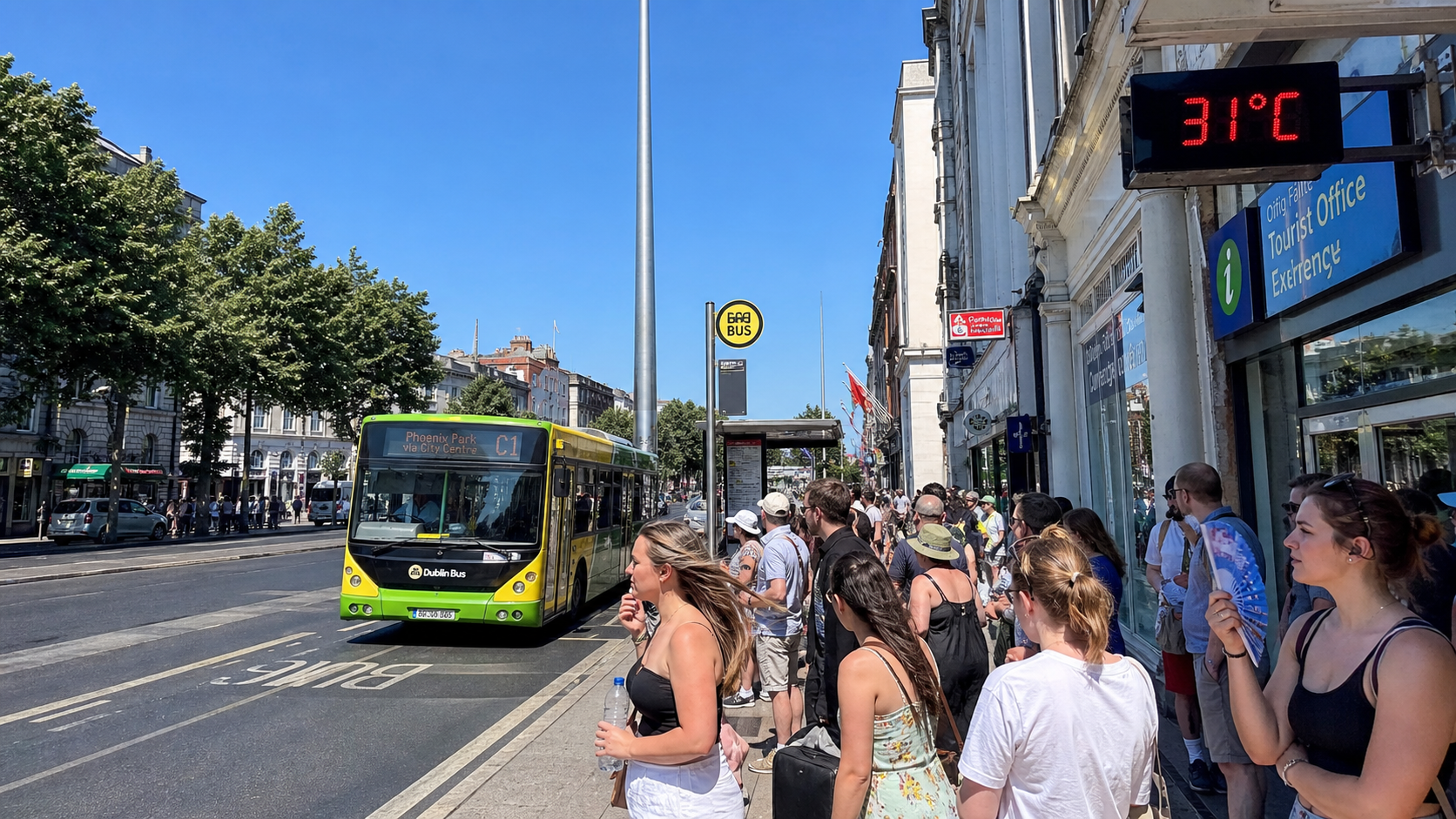
Met Éireann has issued a Status Yellow high-temperature warning for all twelve counties of Leinster and County Tipperary, valid from 6am on Wednesday, 12 August, until 6am on Friday, 14 August, as a persistent high-pressure system drives temperatures well above seasonal norms across the east and midlands. Daytime temperatures are expected to exceed 27°C, with some inland areas in the east and southeast projected to reach between 28°C and 31°C, while nighttime temperatures in urban centres like Dublin and Kilkenny may remain above 18°C.
Background
Ireland's relationship with extreme heat has changed significantly over the past decade. What would once have been considered an exceptional summer temperature — anything above 25°C — is now a regular feature of the Irish summer, a consequence of the broader warming trend that has seen average temperatures across the island rise by approximately 1°C since the pre-industrial era. The frequency and intensity of heatwave events has increased, and the infrastructure of Irish society — housing, healthcare, transport, and agriculture — has been slow to adapt.
The current event is being driven by a ridge of the Azores High that has extended northward across Western Europe, funnelling warm air from Southern Europe toward Ireland and locking it in place with light winds that prevent the coastal cooling that typically moderates Irish summer temperatures. The result is a sustained period of heat that is unusual in its duration and intensity, particularly for the inland counties of Leinster where the moderating influence of the sea is weakest.
The warning covers Carlow, Dublin, Kildare, Kilkenny, Laois, Longford, Louth, Meath, Offaly, Westmeath, Wexford, Wicklow, and Tipperary — a swathe of the country that includes the capital and some of its most densely populated commuter counties. The counties of Munster, Connacht, and Ulster are not under warning, though temperatures across the island are expected to be above average throughout the week.
Key Developments
Met Éireann's forecast for Wednesday and Thursday shows maximum temperatures of 27°C to 29°C across most of the warning area, with the possibility of 30°C or above in sheltered inland locations in counties Carlow, Kilkenny, and Wexford. Nighttime temperatures are expected to remain above 15°C across the warning area, with urban heat island effects pushing minima to 18°C or above in central Dublin, Cork city, and Kilkenny city.
The HSE has activated its heatwave protocols, which include increased monitoring of vulnerable populations — particularly the elderly, those with respiratory or cardiovascular conditions, and people living alone — and enhanced communication through GPs, community pharmacies, and social care services. The public has been advised to stay hydrated, to avoid direct sunlight between 11am and 3pm, and to check on elderly neighbours and relatives.
Uisce Éireann has noted increased demand on water networks across the affected counties and has urged the public to use water responsibly. The Irish Coast Guard and Water Safety Ireland have issued warnings about the dangers of swimming in unpatrolled locations, noting that the combination of hot weather and cold water temperatures creates a significant risk of cold water shock. The Department of Agriculture has raised concerns about wildfire risk in forestry and rural areas, particularly in the drier eastern counties.
The heatwave is also affecting the solar eclipse viewing event scheduled for this evening, with Met Éireann indicating that cloud cover may be variable across the warning area, potentially affecting visibility in some locations.
Why It Matters
Ireland's housing stock is poorly adapted to extreme heat. A significant proportion of Irish homes — particularly older properties built before modern insulation standards — are designed to retain heat rather than to dissipate it, a characteristic that is an asset in the cold and damp conditions that characterise most of the Irish year but becomes a serious problem during heatwaves. Research published earlier this year suggested that up to 10% of Irish housing is at risk of overheating, a figure that is likely to grow as the frequency and intensity of heatwave events increases.
The health consequences of extreme heat are well documented. Heat-related illness — ranging from heat exhaustion to heatstroke — is a significant cause of excess mortality during heatwave events, particularly among the elderly and those with pre-existing health conditions. The HSE has noted that nearly 9,500 people aged 75 or over waited longer than 24 hours for a hospital bed in the first half of 2026, a figure that underlines the system's limited capacity to absorb additional demand generated by heat-related illness.
Local Impact
In Dublin, the heatwave is expected to affect commuters on the Luas and DART networks, where carriages can become uncomfortably hot during peak hours. Irish Rail has indicated that it is monitoring track temperatures on the main lines and may impose speed restrictions if temperatures approach levels that could affect rail integrity. Dublin City Council has opened a number of public cooling centres in libraries and community centres across the city, and the council's parks service has increased the frequency of water fountain maintenance checks. In Kilkenny, Carlow, and Wexford — the counties most likely to see the highest temperatures — local authorities have issued specific advice to farmers about livestock welfare and fire prevention.
What's Next
Met Éireann expects the high-pressure system to begin weakening from Friday, with temperatures returning to more seasonal levels — around 20°C to 22°C — over the weekend. The warning expires at 6am on Friday, 14 August. A separate potato blight advisory has been issued for the affected counties, reflecting the combination of high temperatures and humidity that creates favourable conditions for the disease. The Perseid meteor shower, which peaks on the night of 12–13 August, may be partially visible from the warning area if cloud cover is limited, though the heatwave conditions make clear skies less certain than forecasters would like.